Drone Meteorite Search Platform

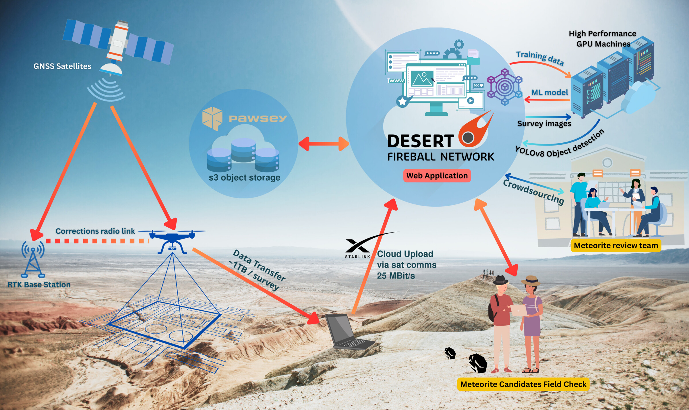
AI-powered detection and collaborative recovery workflows

If you are interested in using the platform, please contact us.

This platform handles:
  • drone data upload for both survey and training data;
  • overview on progress for all steps of the processing;
  • training data labelling;
  • machine learning training and inference (meteorite detection);
  • meteorites candidates review interfaces;
  • GPS-enabled map showing the locations of meteorite candidates for in-situ follow-up (including geo-referenced drone images as overlays);
  • user management, so you can get other people to help review your meteorite candidates.

This service is in principle provided free of charge to members of the research community involved in actively publishing scientific papers, as part of a collaborative agreement with our team.
For commercial operations, personal collectors, and other non-research uses, contact us so we can discuss commercial arrangements.

System architecture diagram: survey drones, data pipeline, ML training & inference, candidate review, field follow-up.
Architecture overview: data flows from drone capture through ML inference to field recovery.